

Foresight constellation grows, improving Earth observation coverage.
Abu Dhabi: The UAE has advanced its position in the global space economy with the entry into full operation of three new Earth observation satellites, significantly boosting its capability to monitor ground activity in near real time.
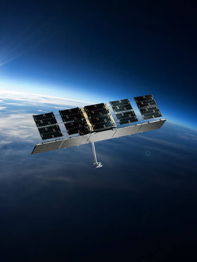
Space42 announced on Tuesday that Foresight-3, Foresight-4 and Foresight-5 are now fully operational, expanding its Earth Observation constellation to five Synthetic Aperture Radar (SAR) satellites.
The expansion is expected to enhance the delivery of high-resolution geospatial intelligence to governments, businesses and strategic partners worldwide, strengthening the UAE’s remote sensing and space-based data capabilities.
Key regions
The three satellites were launched in November 2025 and have now completed their commissioning and testing phases. Their addition increases coverage over key regions, improves revisit rates, and enhances the constellation’s ability to deliver reliable intelligence regardless of weather conditions or time of day.
The satellites were developed in partnership with Finland-based ICEYE as part of wider efforts to strengthen local capabilities and enable technology transfer to the UAE.
Critical integration and testing work was carried out at Space42 Space Systems’ Assembly, Integration and Testing facility in Abu Dhabi, further supporting the country’s ambition to develop a sustainable domestic space industry.
Greater speed
Hasan Al Hosani said the expanded satellite constellation will strengthen the UAE’s sovereign Earth observation capabilities while also improving the company’s competitiveness in global markets.
“With Foresight-3, -4, and -5 now live, we are expanding sovereign Earth observation with greater speed and consistency to governments, industries, and partners worldwide,” Al Hosani said.
“The collaboration with ICEYE and the proven operational success within the Space42 Space Systems facility has strengthened national capability to a level that competes with and scales across global markets. The constellation further delivers against our strategy to become the preferred partner for premium geospatial data, while growing the UAE’s position in a dynamic, mission-critical industry.”
Feed imagery
The new satellites operate in mid-inclined Low Earth Orbit, extending monitoring coverage across regions where more than 90% of the global population lives. Together, they feed imagery into Space42’s AI-powered geospatial intelligence platform, GIQ, which converts raw satellite data into actionable insights within minutes.
By operating in complementary orbital paths, the system is designed to ensure consistent surveillance and data collection throughout the day. The satellites can capture imagery with a resolution of up to 25 centimetres and can see through cloud cover and adverse weather conditions, making them especially useful for disaster response, infrastructure monitoring and security applications.
Emergency response impact
According to Space42, the AI-driven analytics platform can reduce emergency response times by up to 90%, lower predictive maintenance costs by as much as 30%, and cut operational inefficiencies by around 25%.
The announcement comes amid rapidly rising global demand for Earth observation services, as governments and industries increasingly depend on geospatial intelligence to manage risks, improve operational efficiency and meet sustainability goals.
Industry estimates suggest Earth observation insights could generate more than $700 billion in economic value globally by 2030, while also supporting emissions reduction efforts across multiple sectors.
Space sector strategy
The UAE has identified the space industry as a strategic growth pillar under its UAE National Space Strategy 2030, with investments centred on sovereign infrastructure, advanced manufacturing and artificial intelligence.
The expansion of the Foresight constellation marks another milestone in this strategy, combining locally integrated space assets with AI-driven analytics to position the UAE as an emerging global provider of advanced Earth observation and geospatial intelligence services.
